| Collector | Freire, A. |
| Number | 1087 |
| Collected with | et.al. |
| Country | Ecuador |
| Subpart | Loja |
| County | |
| Locality | Carretero A,maluza-Cariamanga, colecciones a 1 km antes de Cariamanga |
| Coordinates | 4° 21' S 79° 32' W |
| Minimum elevation (m) | 2250 |
| Maximum elevation (m) | 2250 |
| Start date | 1988/02/29 |
| End date | 1988/02/29 |
| Family | Asteraceae |
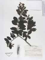
| Identification | Dasyphyllum popayanense (Hieron.)Cabrera |
| Determined by | Paula de Lima Ferreira |
| Identification qualifier | |
| Field notes | Arbol de 5 m, hojas con haz verde muy oscuro, enves verde menos oscuro, capitulos cafes. Creciendo en zona seca |
|
 This record
 Other records of Dasyphyllum popayanense